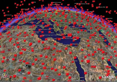
 As the internet becomes intertwined with the real world, the resulting Geoweb is another important stepping stone for the rise of the 3D Internet.
Geoweb (or The ‚Geospatial Web’) stands for the merging of geographical (location-based) information with the mainly abstract information that is currently found on the internet.
Geowebbing is about a reordering of the internet around a geographic interface. Geography and location become more and more important to index information.
This creates an environment where people can search for things based on location instead of by keyword only. The geoweb will allow users to perform searches without even having a need to type in keywords – one will be able to just browse around in a digital map.
Virtual globes or Geobrowsers such as Google Earth and NASA World Wind as well as mapping websites such as Yahoo Maps, Google Maps and Microsoft Live Search Maps (Live Local 3D) have been major factors in raising the interest in the Geoweb.
John Hanke, head of Google’s Earth and Maps division:
Geography is another way, a different way, to organise information. As human beings, we inherently understand geography.
Google Earth is turning into a map of historical significance. It is going to be a map of the world that is more detailed than any map that’s ever been created.(John Hanke)
More and more real world data is being combined with virtual geographical data which results in exciting possibilities to make our lives easier: Locate nearby restaurants, get driving directions, or find your friends in a foreign city through your social communities.
If someone is going to a night club and wants to find related places and things of interest nearby, such as a hotel, it is usually more logical and more intuitive to search by location than to do a regular keyword-based search.
Mobile Geoweb and Geobrowser
Soon, we will see the mobile world jumping in: On location-aware mobile phones and personal digital assistants, people will be able to use digital maps and geobrowsers to find information about relevant places which are geographically closest and which are of the greatest interest to the user: Ask for a restaurant and your device will show you where you can finde the nearest one. It will indicate you directions directly on your GPS and even an option to book a table by text message.
The Geospatial Web will have a dramatic impact on managing knowledge, structuring workflows within and across organizations, and communicating with like-minded individuals in virtual communities. It will bring together people of similar interests, browsing behavior, or geographic location. Placeopedia for example combines knowledge (Wikipedia articles) with Google Maps. Flickrvision shows photos at the geographical location right where they were created.
 Post-it notes on Web documents
The new Geoweb, or the reordering of the Internet around a geographic interface, will however only work if information on the Web is indexed geographically. This can be done by adding computer-readable tags to documents which indicate the locations to which they refer. Mike Liebhold, a fellow at Silicon Valley’s Institute for the Future, likens this process to “sticking Post-it notes on to Web documents.”
It is estimated that 60 to 80 percent of Web pages have geographically relevant information that can be indexed. The more detailed the geographical representations of the planet will be created, the more inventive and exciting the interplay between the virtual world and the real world will become.
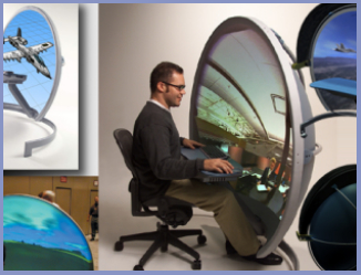
The future of the Geoweb: Fully immersive virtual reality.
The goal of the Geoweb can be seen as the creation of a fully immersive digital environment, or virtual reality that mirrors our own reality. This would greatly improve our understanding of the world and its processes, allowing us to better manage our resources, find nearby services, meet people, and have fun.
Digital Earth by Al Gore
Digital Earth was a label given to a visionary concept by former US vice president Al Gore in 1998. He described a virtual representation of the Earth on the Internet that is spatially referenced and interconnected with the world’s digital knowledge archives.
Geoweb is gradually turning into this digital earth and will soon become the interface to just about everything users do on the Internet. It is one of the most important stepping stones towards the future digital playground called 3D Internet.
(www.internet3d.org)

